Contactez-nous
Connexion
shopping_cart
Panier
(0)
Accueil
DEPARTEMENTS
DOM - TOM
THEMES
ETRANGER
search
clear
Accueil
DEPARTEMENTS
31-HAUTE-GARONNE
LE PLAN
31-HAUTE-GARONNE
.FOLKLORE
ALAN
ANTICHAN-DE-FRONTIGNES
ARBAS
ARGUT-DESSOUS
ARLOS
ARNAUD-GUILHEM
ARTIGUES
ASPET
AUCAMVILLE
AULON
AURIAC-SUR-VENDINELLE
AURIGNAC
AUSSONNE
AUTERIVE
AVIGNONET
AYGREFEUILLE
BAGEN
BAGNERES-DE-LUCHON
BARBAZAN
BAZIEGE
BAZUS
BEAUMONT-SUR-LEZE
BEAUPUY
BEAUZELLE
BERAT
BERTIGNAT
BESSIERES
BLAGNAC
BLAJAN
BOSOST
BOUCONNE
BOUE
BOULOC
BOULOGNE-SUR-GESSE
BOURG-D'OUEIL
BOURG-SAINT-BERNARD
BOUSSAN
BOUSSENS
BOUTX
BRAX
BRUGUIERES
BUZET-SUR-TARN
CADOURS
CALMONT
CARABUILLES
CARAMAN
CARBONNE
CASSAGNABERE
CASTAGNEDE
CASTELBIAGUE
CASTELMAUROU
CASTELNAU-D'ESTRETEFONDS
CASTELNAU-PICAMPEAU
CASTILLON-DE-LARBOUST
CATHERVIELLE
CAUBIAC
CAUBOUS
CAZARIL-LASPENES
CAZEAUX-DE-LARBOUST
CAZERES
CEPET
CHAUM
CHEIN-DESSUS
CIADOUX
CIER-DE-LUCHON
CIERP-GAUD
CINTEGABELLE
CIRES
COLOMIERS
CORNEBARRIEU
COX
CROIX-DAURADE
CUGNAUX
DAUX
DEYME
DONNEVILLE
ENCAUSSE-LES-THERMES
ESTADENS
FENOUILLET
FONSEGIVES
FONSORBES
FORGUES
FOS
FOURQUEVAUX
FRANQUEVIELLE
FRONSAC
FRONTON
GAILLAC-TOULZA
GALIE
GANTIES
GARDOUCH
GARIDECH
GARIN
GOUAUX-DE-LARBOUST
GOURDAN-POLIGNAN
GRAGNAGUE
GRATENS
GRENADE
GREPIAC
GURAN
IZAUT-DE-L'HOTEL
JUZET-D'IZAUT
JUZET-DE-LUCHON
L'ISLE-EN-DODON
LABARTHE-INARD
LABARTHE-RIVIERE
LABARTHE-SUR-LEZE
LABASTIDE-BEAUVOIR
LABASTIDE-CLERMONT
LABASTIDE-DU-SALAT
LABASTIDETTE
LABEGE
LABROQUERE
LACASSE
LACROIX-FALGARDE
LAFITTE-VIGORDANE
LAGARDELLE-SUR-LEZE
LAGRACE-DIEU
LALANDE
LANTA
LAPEYROUSE-FOSSAT
LASSERRE
LATOUR
LAUNAGUET
LAUZERVILLE
LAVELANET-DE-COMMINGES
LAVERNOSE-LACASSE
LAYRAC-SUR-TARN
LE CASTERA
LE FOUSSERET
LE PIN-MURELET
LE PLAN
LEGE
LEGUEVIN
LERDENNE
LES TOURREILLES
LESPINASSE
LESPITEAU
LESPUGUE
LESTELLE-DE-SAINT-MARTORY
LEVIGNAC
LEZ
LHERM
LONGAGES
LOUBENS-LAURAGAIS
LUCHON
LYS
MANCIOUX
MANE
MARIGNAC
MARIGNAC-LASCLARES
MARQUEFAVE
MARTRES-DE-RIVIERE
MARTRES-TOLOSANE
MAURAN
MAURENS
MAURESSAC
MAUVEZIN
MAUZAC
MAZERES-SUR-SALAT
MELLES
MERVILLE
MILHAS
MIRAMONT-DE-COMMINGES
MIREMONT
MIREPOIX-SUR-TARN
MONDONVILLE
MONTAIGUT-SUR-SAVE
MONTASTRUC-LA-CONSEILLERE
MONTAUBAN-DE-LUCHON
MONTBERON
MONTESPAN
MONTESQUIEU-VOLVESTRE
MONTGAILLARD-DE-VILLEFRANCHE
MONTGISCARD
MONTJOIRE
MONTLAUR
MONTREJEAU
MONTSAUNES
MURET
NAILLOUX
NOE
ODARS
ONDES
OO
PALAMINY
PAULHAC
PECHBONNIEU
PEGUILHAN
PEYSSIES
PIBRAC
PINSAGUEL
PLAGNOLE
PLAISANCE-DU-TOUCH
POINTIS-DE-RIVIERE
POINTIS-INARD
PORTET-D'ASPET
PORTET-DE-LUCHON
PORTET-SUR-GARONNE
POUBEAU
POUCHARRAMET
POUY-DE-TOUGES
PUYDANIEL
PUYMAURIN
RAZECUEILLE
REBIRECHIOULET
RENNEVILLE
REVEL
RIEUMES
RIEUX
ROQUEFORT-SUR-GARONNE
ROQUESERIERE
SACCOURVIELLE
SAIGUEDE
SAINT-AVENTIN
SAINT-BEAT
SAINT-BERTRAND-DE-COMMINGES
SAINT-CEZERT
SAINT-CLAR-DE-RIVIERE
SAINT-ELIX-LE-CHATEAU
SAINT-ELIX-SEGLAN
SAINT-FELIX-LAURAGAIS
SAINT-FERREOL
SAINT-GAUDENS
SAINT-GENIES-BELLEVUE
SAINT-JEAN
SAINT-JEAN-LHERM
SAINT-JORY
SAINT-JULIA
SAINT-JULIEN
SAINT-LAURENT
SAINT-LEON
SAINT-LOUP-CAMMAS
SAINT-LYS
SAINT-MAMET
SAINT-MARCEL-PAULEL
SAINT-MARCET
SAINT-MARTIN-DU-TOUCH
SAINT-MARTORY
SAINT-MICHEL
SAINT-ORENS-DE-GAMEVILLE
SAINT-PAUL-D'OUEIL
SAINT-PAUL-SUR-SAVE
SAINT-PE-D'ARDET
SAINT-ROME
SAINT-SAUVEUR
SAINT-SIMON
SAINT-SULPICE-SUR-LEZE
SAINTE-FOY-DE-PEYROLIERES
SAINTE-LIVRADE
SAJAS
SALEICH
SALIES-DU-SALAT
SAUVETERRE-DE-COMMINGES
SAVERES
SEILH
SENGOUAGNET
SEOULE
SEYSSES
SODE
SOUEICH
SUPERBAGNERES
TORLA
TOUILLE
TOULOUSE
TOURNEFEUILLE
TREBONS-DE-LUCHON
URAU
VACQUIERS
VALCABRERE
VALENTINE
VARENNES
VAUX
VENASQUE
VENERQUE
VERFEIL
VERNET
VIELLA
VIGNAUX
VILLAUDRIC
VILLEMATIER
VILLENEUVE-DE-RIVIERE
VILLENEUVE-LES-BOULOC
VILLENEUVE-TOLOSANE
ok
Catégorie : LE PLAN
Il y a 3 produits.
Trier par :
Pertinence
Ventes, ordre décroissant
Pertinence
Nom, A à Z
Nom, Z à A
Prix, croissant
Prix, décroissant
Référence, A à Z
Référence, Z à A
Affichage 1-3 de 3 article(s)
Filtres actifs
Aperçu rapide
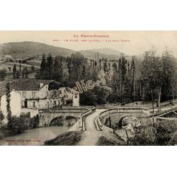
LE PLAN
12,00 €
Aperçu rapide
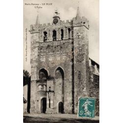
LE PLAN
12,00 €
Aperçu rapide
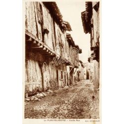
LE PLAN
12,00 €
Affichage 1-3 de 3 article(s)
Retour en haut
check_circle
check_circle